Thessaly FloodHub: Greece volunteers united against Cyclone Daniel using Ushahidi

Thessaly FloodHub is a volunteer-based mapping platform that was used in Greece to map flood events, assess infrastructure damage, identify community needs and relief centers, and spotlight volunteer opportunities to facilitate disaster recovery and enhance community resilience. Thessaly was the most affected region in Greece, and therefore, immediate intervention was needed.
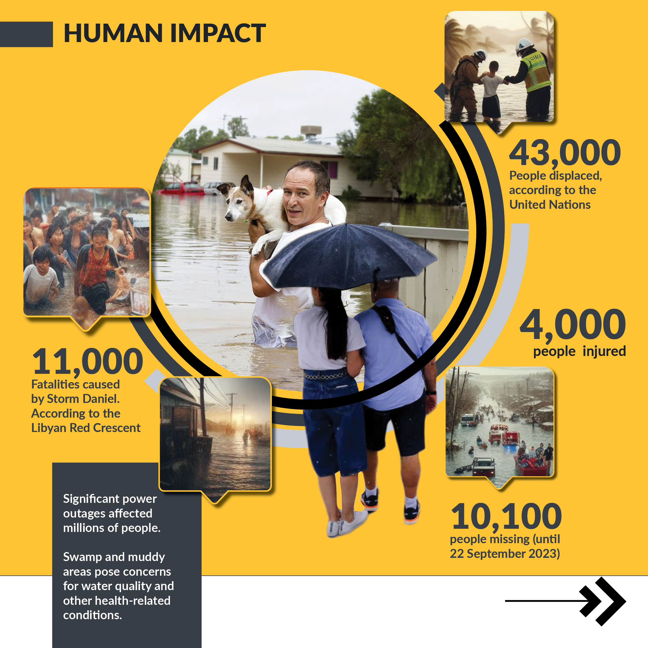
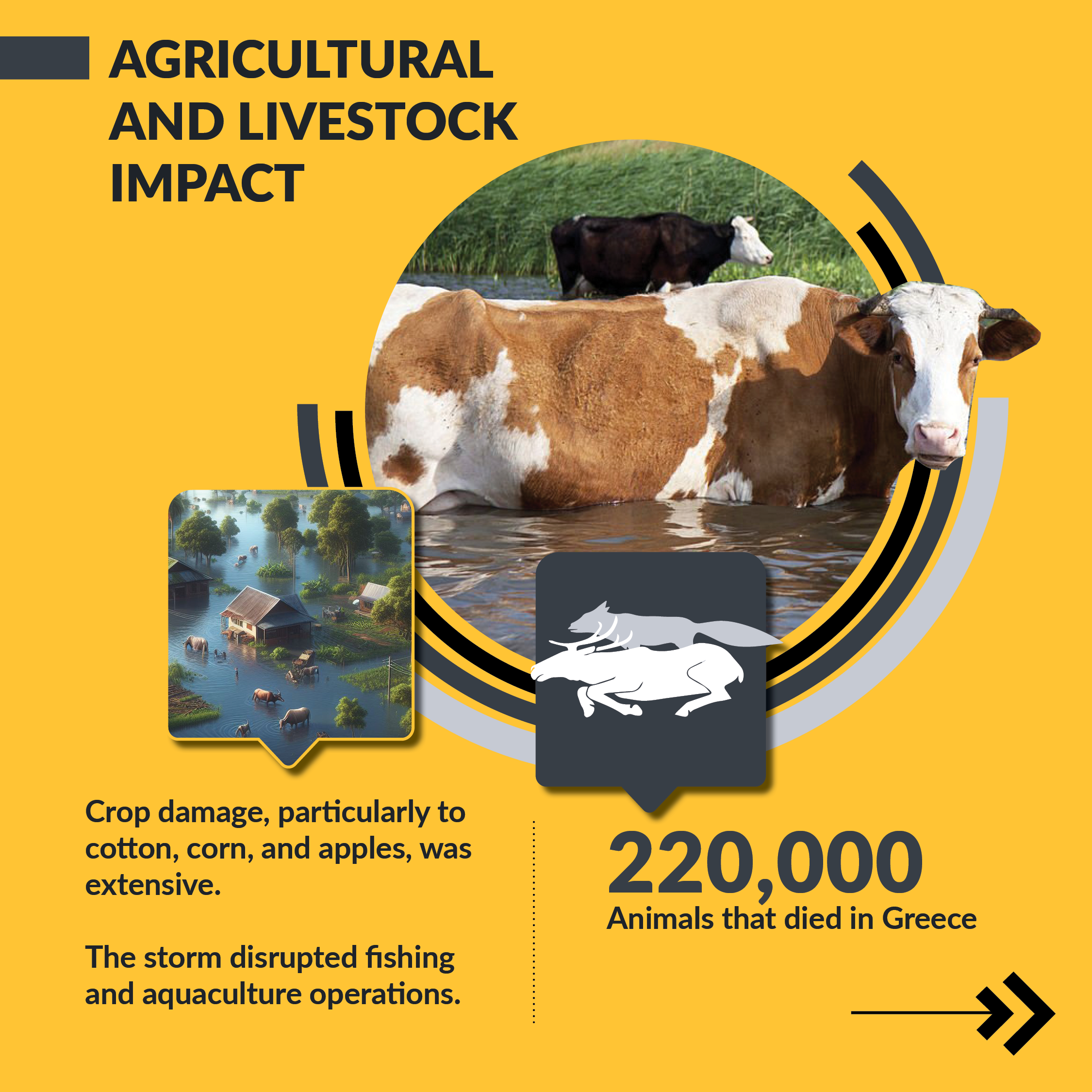
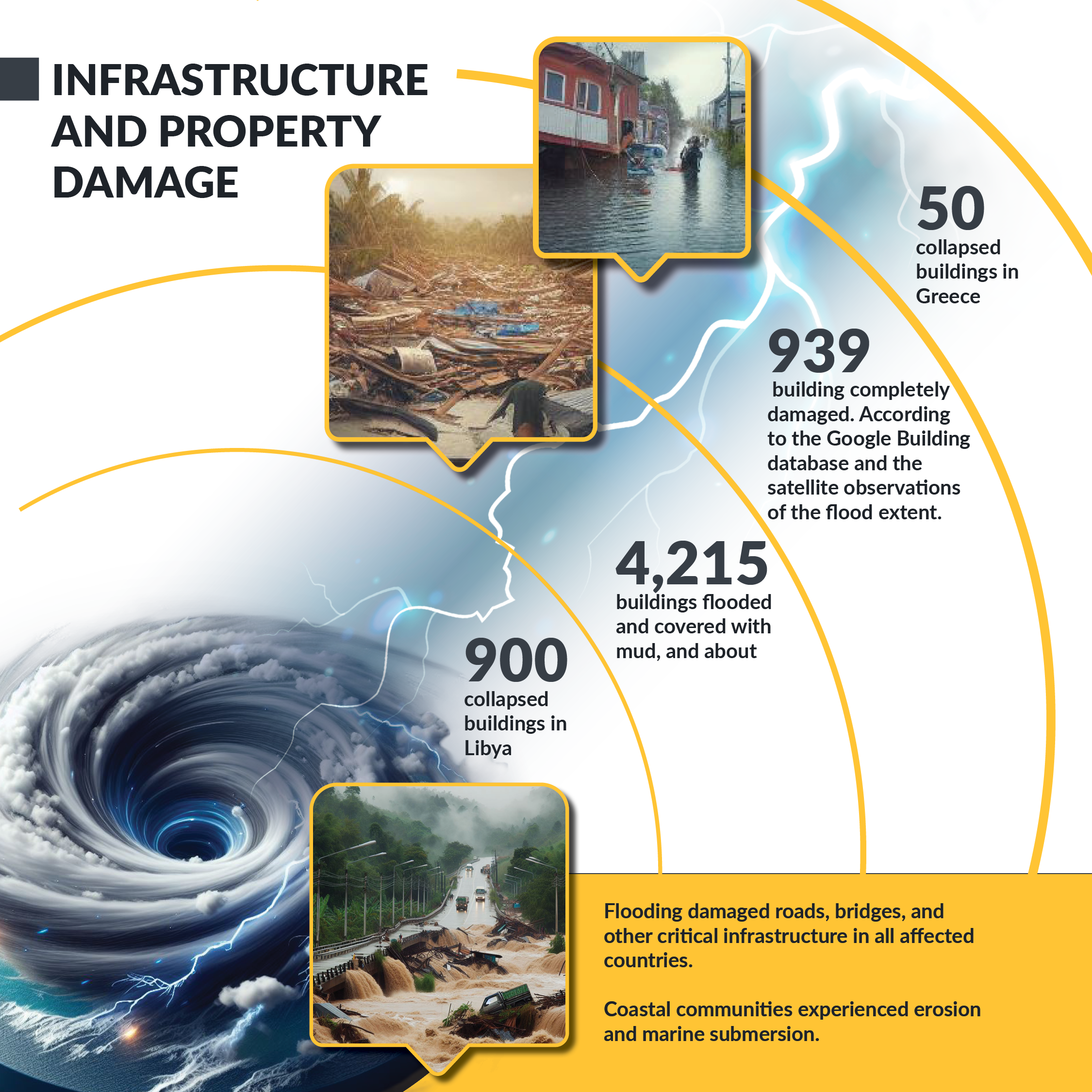
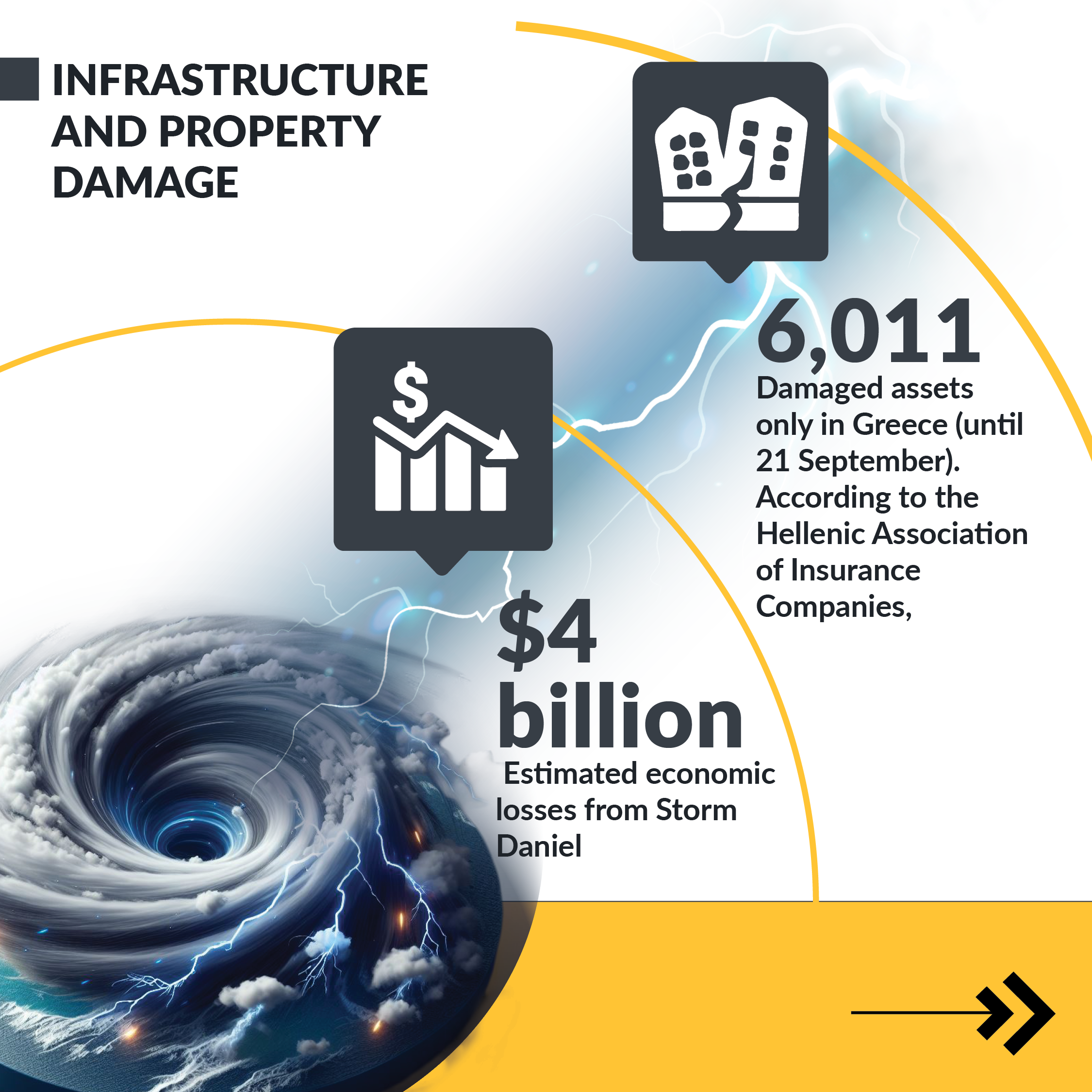
Storm Daniel landed in the eastern Mediterranean from September 3 to September 11, 2023. It was the deadliest, most powerful and destructive Mediterranean cyclone recorded in the history of Greece, Bulgaria, Turkey, and Libya.
Impact of the Cyclone
Utilizing the Ushahidi Platform
The impact of the cyclone brought together like-minded volunteers from different professions who aimed to facilitate disaster recovery and enhance community resilience. Panos Karas, a UX/UI designer born and lived in Greece, came together with other volunteers to build community resilience in Thessaly, Greece, by mapping flood events, infrastructure damage, and community needs and relief centers using Ushahidi. Information on the platform was mainly in Greek, a language spoken by about 99% of Greece’s communities. Through the deployment, the Thessaly FloodHub team managed to:
- Interact with 1200 community members through the Platform
- Create 12 surveys
- Collect 27 reports
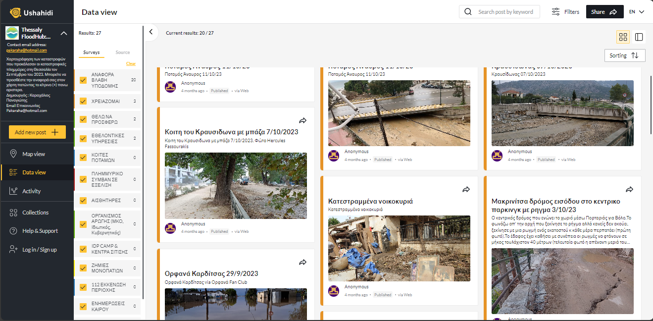 The ability of the platform to collect photos played an essential role in the community to collect visual evidence of events happening in their home area. During crisis situations, photos play a significant role in helping communities understand the magnitude of the situation, preventing more human damage.
Outcomes and Way Forward
During crises such as floods, communities feel helpless and defeated as movement is minimal and aid takes time. At this moment, Ushahidi provides a technology platform for the communities to report events in near real-time as they unfold. Thessaly FloodMap utilized existing channels available in the communities’ hands. Communities were able to provide information using the Mobile App (android and iOS), Web App, and emails to report flooding events and risks as they unfold.
Survey forms were created around flooding events, infrastructure damage reports, community needs reports, and voluntary offer reports. This information was made available to the government, community, NGOs, and CSOs working in relief efforts. Although the organizing was purely based on volunteers, more effort should have been put into creating awareness of the platform for maximum use by the stakeholders involved. In retrospect, the project should have expanded awareness further to include radio, which remains prime for communication with hard-to-reach communities. Strong coalitions and multi-level connections are necessary for a coordinated way for individuals and CSOs to reach large and diverse audiences and constituencies during such times.
Data collected on the platform gives the government and relevant stakeholders an opportunity to rework drainages and amenities to prevent such occurrences in the future.
Results and insights from Thessaly FloodHub case study give us hope that as technology becomes part and parcel of our everyday lives, organizations working in the community have the unique opportunity to integrate it into their work to not only raise the voices of those who would otherwise be unheard but also coordinate relief efforts in the most affected communities.
1200
Community members engaged
12
Surveys created
27
Reports collected
Published Evidence
- Thessaly FloodHub Deployment
Ushahidi Platform