Insights from the Humanitarian OpenStreetMap Summit 2017

Sep 27, 2017
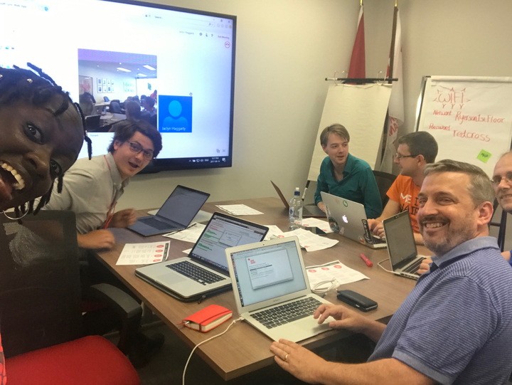
A handful of Ushahidi staff attend the HOT(Humanitarian OpenStreetMap) Summit between 14th and 15th September. This was the 3rd annual summit the organisation has hosted, bringing together members of the global OSM(OpenStreetMap) Community, technology and GIS enthusiasts working in the humanitarian space for two days of talks and engaging discussions on creating meaningful impact through mapping.

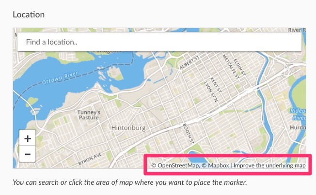
As we’ve mentioned before in the past, deployments on the Ushahidi platform are heavily reliant on quality base maps for accurate geolocation of reports. The HOT OSM team plays a vital role through their rapid mobilisation to provide data and maps to support humanitarian response efforts( as seen most recently during Hurricane Maria and the Mexico Earthquake).
Attending this summit gave the Ushahidi team an opportunity to interact with the OSM community, get a better understanding of how OSM works, as well as identify ways of strengthening our growing collaboration with OSM through improvements in software, as well as our engagement strategies. It also greatly validated the importance of building links to improve the OSM map base layer within the Ushahidi platform, which we just added.
The summit hosted a series of lightning talks, breakout sessions, and workshops that gave the Ushahidi team an opportunity to immerse itself in tools that our platform and our users benefit from.
We got to attend the OSM mapathon and dive into mapping on existing HOT OSM tasks. It was great to get a better understanding of what mapping on OSM entails, and appreciated the ease of onboarding for volunteers who are new to OSM.
The machine learning breakout session particularly peaked our interest, as we’ve been internally exploring ways of automating data grooming on the Ushahidi platform. Machine learning is omni present now, the barrier to use has dropped significantly and it actually works. Use cases shared during the discussion primarily focused on classification and categorisation, though some computer vision elements are being applied to mapping and map annotation. It’ll be interesting to see the role ML will play in the near future to increase efficiency and speed of humanitarian response efforts.
Ushahidi hosted a one hour workshop simulating use of the platform and Open Streetmap in crisis situations ( as was seen during the Nepal Earthquake and Peru floods ), to familiarise participants with organizing and coordinating crisis response in using Ushahidi.We had participants sharing and managing data around a fake green plague. Reporters roamed around the summit venue, sending reports via SMS, Email and our smartphone apps, while managers structured and published the data.
@ushahidi management center supporting the #greenterror initiative. Workshopping in action at the #HOTSummit @hotosm pic.twitter.com/LXglJlvrNy
— Rachel V (@RachelKVanNice) September" class="redactor-linkify-object">https://twitter.com/RachelKVan... 15, 2017
You can learn more about getting involved with HOT and contributing to OSM.
In the coming weeks, we plan to share more updates on practical steps we’re taking based on lessons learned and conversations with HOT OSM team members. Stay tuned for more updates on Twitter or Facebook, and our blog.